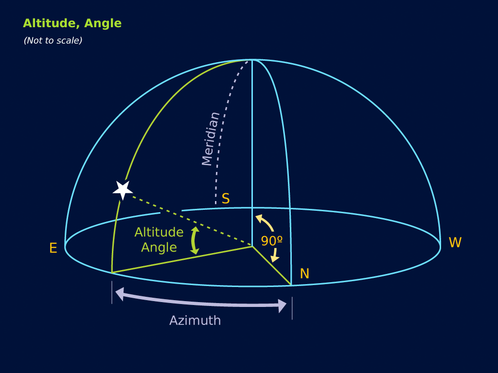
Altitude is the distance measured in degrees above the horizon. An object on the horizon is at zero degrees. An object directly above you—a point called the zenith—is at 90 degrees. The imaginary line that connects north to south through the zenith is called the local meridian.
Polaris and Latitude
You can determine your latitude above the equator by measuring the altitude of Polaris, the North Star. In fact, this method has been used for centuries for navigation at sea.And so, with these coordinates, we can fix the position of any object in the sky . . . or can we? The altitude and azimuth of an object changes as we change positions on Earth. And since the Earth is constantly rotating, these coordinates also change with the time of day!
For this reason, you may wonder why local coordinates are used at all! The answer is that backyard astronomers find them very easy to use. When planning to observe a specific object or event, all one needs to remember is a time and a rough location in the sky, and with a little practice, you can find anything you are looking for.
 Altitude angle.