 The Celestial sphere.
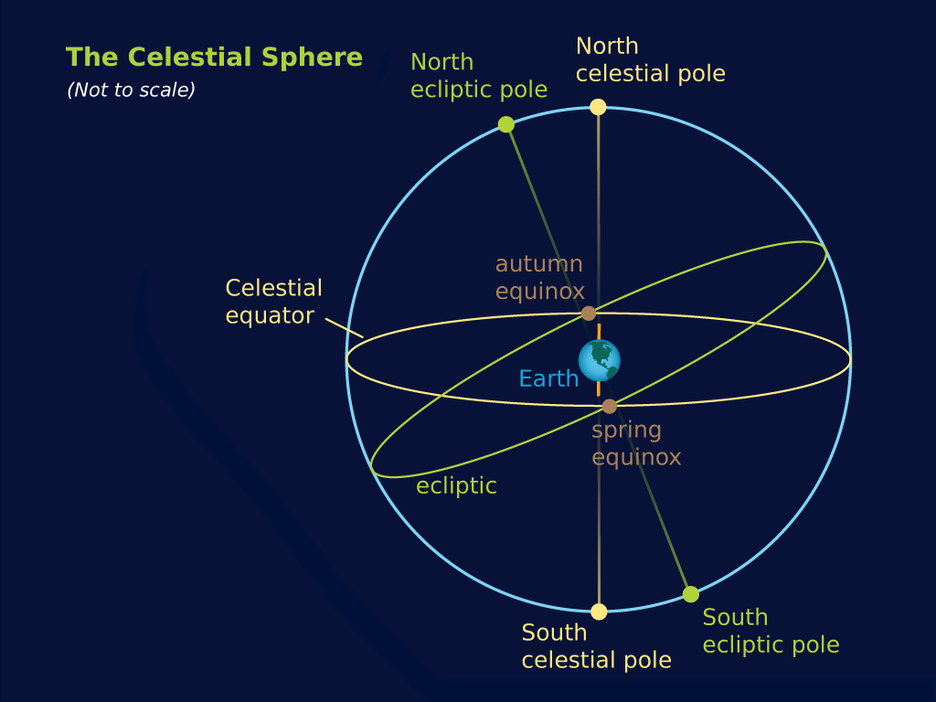
To correctly envision the equatorial coordinate system you must imagine a large grid covering the entire sky, fixed to the background stars (forming the celestial sphere). At the top of the grid is the north celestial pole—where we always find Polaris, our North Star—and at the bottom is the south celestial pole. In between is a great circle known as the celestial equator, which divides the sky into two hemispheres, north and south.
If you are standing anywhere on the Earth's equator, the celestial equator is always directly overhead . . . it crosses the zenith. Sometimes it helps to think of the celestial equator as just the extension of the Earth's equator out into space.
The celestial equator is our zero point for declination. Much like the horizon in local coordinates, the celestial equator allows us to give any object a declination in degrees, minutes (1/60 of a degree), and seconds (1/60 of a minute) above or below this line in the sky. Positions above the celestial equator have positive declination, positions below are negative.
Polaris, which is only very slightly offset from our celestial north pole, has a declination of +89 degrees, 16 minutes. Remember that this coordinate system is fixed to the stars; only objects that move—such as planets, comets, and asteroids—have measurably changing right ascension and declination coordinates.